Correze - A Road Less Ridden
Introducing 185km of hills, history, and four riders
Standings
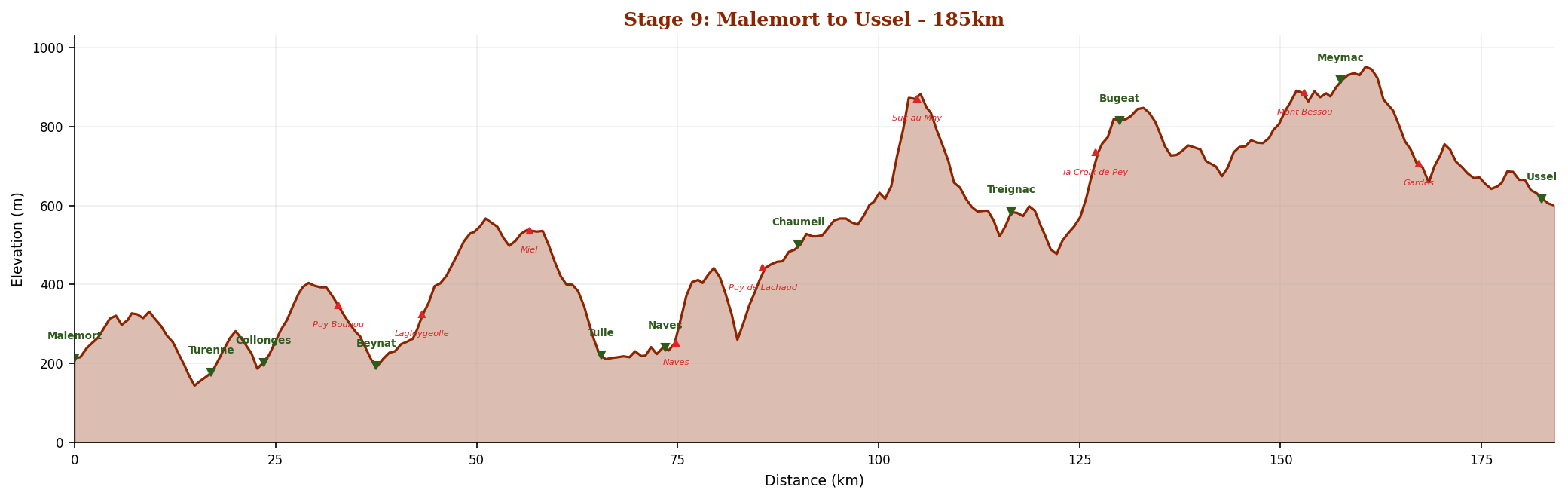
See full standings ↓Elevation Profile
Scroll to zoom, drag to pan. Double-click to reset.
Power Stats
Reference: 70kg rider + 8kg bike, CdA 0.35, Crr 0.005
Estimated Time

Correze - A Road Less Ridden
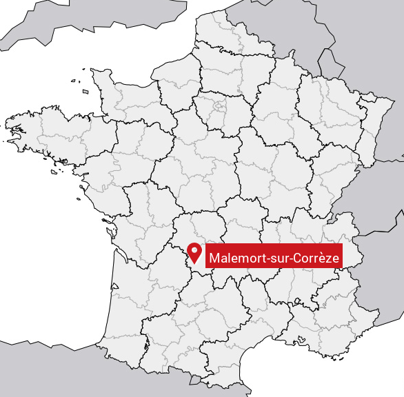
On Sunday, July 12, 2026, the Tour de France peloton will roll out of Malemort-sur-Correze and ride 185 kilometers northeast to Ussel. It will be Stage 9 - the first time this route has ever been raced.
This year sees us completing Stage 9 from Malemort to Ussel. It looks like a deceptively hard day. Officially classed as hilly, it runs 185 km through Correze and packs in about 3,300 metres of climbing. It feels like classic breakaway terrain, with climb after climb gradually wearing riders down rather than one single decisive summit. The race organisation has singled out Suc au May and Mont Bessou as the points most likely to create real separation before the final rolling run into Ussel. It is also a nice piece of Tour history, since both Malemort and Ussel are first-time stage towns on the 2026 route.
Between now and then, we're going to ride it ourselves. Not all at once, and not at 45 kilometers an hour. Instead, we'll cover the route segment by segment, published twice a week.
The Location
The road climbs from the limestone lowlands around Brive-la-Gaillarde into the granite heart of the Massif Central. It passes through medieval villages built from red sandstone, descends into the valley of Tulle - the departmental capital, famous for lace and accordions - then climbs again through the wild Monedieres hills and across the vast, empty Plateau de Millevaches before dropping into Ussel.
Along the way: nine categorized climbs, including the fierce Suc au May at 7.7%. Two "Plus Beaux Villages de France." A summit at 977 meters on Mont Bessou, the highest point in the Correze. And everywhere, the quiet green countryside that most of the world has never heard of.
The Route
The official Stage 9 parcours covers 185km with roughly 3,300 metres of climbing. The profile tells the story: a gradual ramp from the lowlands into the hills, with the hardest climbing concentrated in the second half between Tulle and Meymac.
The Four Riders
Our maximum daily distance that will be tracked is 2 kilometers. As per last year there will be rolling statistics for total distance covered, who is in the lead, most consistent, best 3-day average, and more. There will be biweekly updates with a smattering of local cultural and historical content.
The riders:
- Justin - aiming to finish before the peloton does
- Marian - steady and strategic
- Nan - unpredictable bursts of distance
- Wally - the dark horse
Their progress will be tracked in every entry, updated with each publication.
A Short Introduction to Malemort

According to the municipal history page, Malemort is a fairly new commune in its current form, created in 2016 when Malemort-sur-Correze and Venarsal were merged into a single 'commune nouvelle'. It describes itself as a 'town in the countryside'. The commune has a deeper past than expected for a suburban-looking town: Malemort still has references to Lacan caves, Gallo-Roman remains, the Saint-Xantin church, the Breniges towers, and other old sites we will be seeing along the way. The town also says that in the Middle Ages it was one of the three principal lordships of the Bas-Pays - apparently a way of saying it was locally powerful and important in medieval times, not just a small village.
What to Expect
Each entry will cover one 7-kilometer segment of the route. You'll find:
- A map showing exactly where we are on the road
- An elevation profile with gradient coloring and power estimates
- The story of what's there - the history, the scenery, the people, the geology
- Rider standings - who's ahead, who's falling behind, who had a big week
- Weather at the segment's location on the day of publication
- Images from Wikimedia Commons and other Creative Commons sources
Stage 9 happens on July 12th. And so it begins. Onward!
Coming Up Next
Points available in the next segment:
Rider Standings
as of April 5, 2026
| Stat | Justin | Marian | Nan | Wally |
|---|---|---|---|---|
| Total (capped) | 8 km | 8 km | 8 km | 5.1 km |
| Daily avg (actual) | 4.62 km | 2 km | 3.25 km | 1.28 km |
| Daily avg (capped) | 2 km | 2 km | 2 km | 1.28 km |
| Longest day | 7.5 km | 2.7 km | 4.7 km | 2.5 km |
| Best 3-day | 15.6 km | 7 km | 11.1 km | 5 km |
| Recent 5-day avg | 4.62 km | 2 km | 3.25 km | 1.28 km |
| Days <3km | 1 | 4 | 1 | 4 |
| Sprint pts | 3 | 2 | 5 | 1 |
| Climb pts | 2 | 0 | 1 | 0 |
| Remaining | 177 km | 177 km | 177 km | 179.9 km |
| Est. finish | Jul2 | Jul2 | Jul2 | Aug24 |